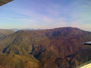
On the 1st June 2010, I arrived at Stellenbosch Flying club. On this day I was to conduct my first solo navigation exercise. My routing would be FASH(Stellenbosch)-Paarl-Worcester(for a touch and go)-Grabouw-Somerset West-FASH. I went into the flight training center, printed out my flight document to sign to show I took the plane. I then checked the weather and NOTAMs for my route. I did all my fuel calculations and once everything was sorted out I went out to the plane. I checked and saw that it needed fuel so I quickly taxied it over to the fuel bay and filled ZS-KUI up. I then taxied to the runway and took off at 14:55. Airborne out of FASH and it was a quick climb up to 1500' and fix a heading for Paarl. I reached Paarl quickly and turned east to face the Du Toitskloof mountain range. These mountains are quite high and I had been warned of bad turbulence so I climbed up to 5500' and strapped everything down just in case. Halfway across the mountains I hit the worst turbulence I had experienced so far and dropped 1000'! A quick recovery and I was over the mountains seconds later. Then it was a quick descent down into Worcester. I pulled off a very smooth touch and go and proceeded onto my next waypoint-Grabouw. On the way to Grabouw I passed over the Theewaterskloof dam. I enjoy flying over it because I have many great memories of camping there. After passing over Grabouw it's a right turn towards the west passing over Sir Lowrys pass and over my hometown of Somerset West. I passed right over my granparents house and my house. I then turned North, heading around the Helderberg and touched down back at FASH at 1613. I taxied back to the hanger and shut down at 1615. It was a very enjoyable flight and one that I will repeat many more times!


